MAKE A MEME
View Large Image
| View Original: | 1743_Homann_Heirs_Map_of_West_Africa_(_Slave_Trade_references_)_"Guinea"_-_Geographicus_-_Aethiopia-hmhr-1743.jpg (3000x2562) | |||
| Download: | Original | Medium | Small | Thumb |
| Courtesy of: | commons.wikimedia.org | More Like This | ||
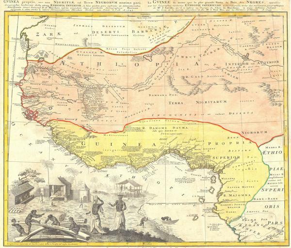
| Keywords: 1743 Homann Heirs Map of West Africa ( Slave Trade references ) "Guinea" - Geographicus - Aethiopia-hmhr-1743.jpg One of the finest maps of west Africa to appear in the mid 17th century Details West Africa from Cape Blanc and Senegal to Guinea Inferior and the Cacongo and Barbela Rivers Extends inland to including Ghana Lake on the Niger River as far as Regio Auri The coast is highly detailed with numerous notations in Latin regarding the peoples and tribes of the region The detail extends inland along some river valleys most specifically the Niger however the map becomes quite vague the farther the river flows inland Features an elaborate engraving in the lower left depicting ivory Africa tribespeople and a small village 1743 Size in 23 19 object history credit line accession number Aethiopia-hmhr-1743 Geographicus-source PD-Art-100 Maps by Homannsche Erben 1743 maps 1740s maps of Africa Slavery-related maps Maps in Latin Slavery in Islam | ||||
_"Guinea"_-_Geographicus_-_Aethiopia-hmhr-1743.jpg)