MAKE A MEME
View Large Image
| View Original: | 1762_Bonne_Map_of_Egypt_-_Geographicus_-_Egypt-bonne-1762.jpg (2443x3500) | |||
| Download: | Original | Medium | Small | Thumb |
| Courtesy of: | commons.wikimedia.org | More Like This | ||
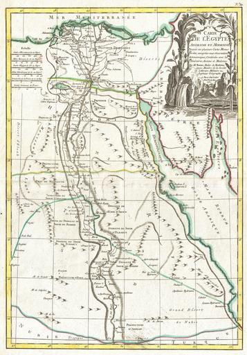
| Keywords: 1762 Bonne Map of Egypt - Geographicus - Egypt-bonne-1762.jpg A beautiful example of Rigobert Bonne's 1762 decorative map Egypt Covers from the Nile Delta south as far as Aswan and the border with Nubia and includes the Sinai and parts of the Red Sea Makes note of both ancient and modern c 1762 sites Details various Sheikdoms Prefectures and Provinces throughout An elaborate decorative title cartouche in the upper right quadrant features stylized date palms the Nile cataracts and a typically monstrous Nile crocodile Drawn by R Bonne in 1762 for issue as plate no 29 in Jean Lattre's 1776 issue of the Atlas Moderne 1762 dated Size in 12 5 18 object history credit line accession number Egypt-bonne-1762 Lattre Jean <i>Atlas Moderne ou Collection de Cartes sur Toutes les Parties du Globe Terrestre</i> c 1775 Geographicus-source PD-old-100 Maps by Rigobert Bonne Old maps of Egypt 1762 maps Old maps of the Nile French language maps of Egypt Maps of river deltas Egyptian Halayeb Triangle in 1762 | ||||