MAKE A MEME
View Large Image
| View Original: | 1770_Bonne_Map_of_Chinese_Tartary,_Mongolia,_Manchuria_and_Korea_(Corea)_-_Geographicus_-_TartarieChine-bonne-1770.jpg (4000x2922) | |||
| Download: | Original | Medium | Small | Thumb |
| Courtesy of: | commons.wikimedia.org | More Like This | ||
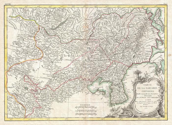
| Keywords: 1770 Bonne Map of Chinese Tartary, Mongolia, Manchuria and Korea (Corea) - Geographicus - TartarieChine-bonne-1770.jpg A beautiful example of Rigobert Bonne's 1770 decorative map of Chinese Tartary Covers from the Lop Nor region eastward to Korea Manchuria Sakalin and Jeso-Gasima Hokkaido Includes both Inner Mongolia and Outer Mongolia Extends north to include Lake Baikal Names numerous towns cities and river systems Shows the Great Wall of China At the far eastern extreme of this map Jeso-Gasimia or Hokkaido is mapped speculatively along its northern shore The island of Sahalien or Sakhalin also appears with erroneous shores A decorative title cartouche appears in the lower right corner This is an uncommon and rarely seen map Drawn by R Bonne in 1770 for issue as plate no A 27 in Jean Lattre's 1776 issue of the Atlas Moderne 1771 dated Size in 17 12 object history credit line accession number TartarieChine-bonne-1770 Lattre Jean <i>Atlas Moderne ou Collection de Cartes sur Toutes les Parties du Globe Terrestre</i> c 1775 Geographicus-source PD-old-100 Maps by Rigobert Bonne 1771 maps 18th-century maps of China Old maps of Korea Old maps of Mongolia | ||||
_-_Geographicus_-_TartarieChine-bonne-1770.jpg)