MAKE A MEME
View Large Image
| View Original: | 1771_Bonne_Map_of_Central_Asia_-_Geographicus_-_Tartarie-bonne-1770.jpg (4000x2808) | |||
| Download: | Original | Medium | Small | Thumb |
| Courtesy of: | commons.wikimedia.org | More Like This | ||
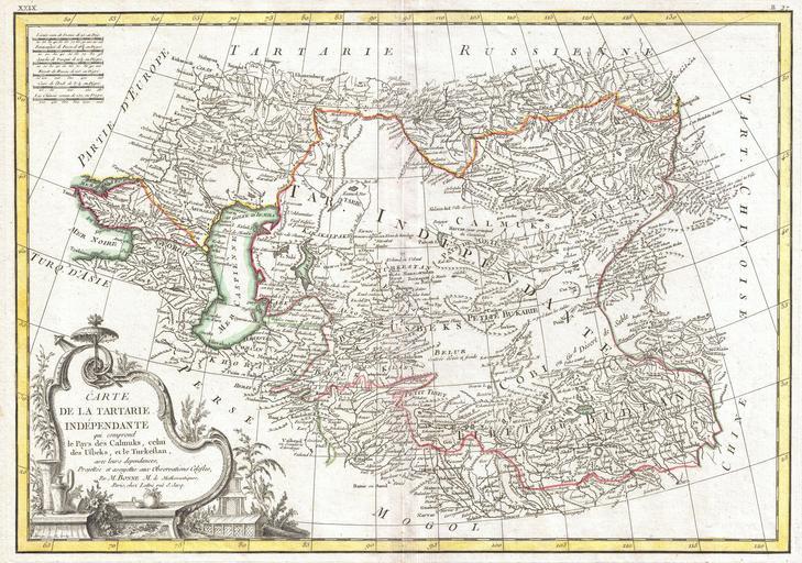
| Keywords: 1771 Bonne Map of Central Asia - Geographicus - Tartarie-bonne-1770.jpg A beautiful example of Rigobert Bonne's 1770 decorative map of Central Asia Covers from the Black Sea south to China north to Russia and south to Persia and India Includes the modern day nations of Kazakhstan Uzbekistan Turkmenistan Georgia Armenia and Azerbaijan with parts of adjacent Turkey Saudi Arabia and Pakistan Names numerous tribal areas villages cities deserts Silk Route way stations and river systems A large decorative title cartouche in the lower left quadrant features articles supposedly common to the region Drawn by R Bonne in 1770 for issue as plate no B 27 in Jean Lattre's 1776 issue of the Atlas Moderne 1770 undated Size in 17 5 12 5 object history credit line accession number Tartarie-bonne-1770 Lattre Jean <i>Atlas Moderne ou Collection de Cartes sur Toutes les Parties du Globe Terrestre</i> c 1775 Geographicus-source PD-old-100 1770 maps Maps of Central Asia Old maps of Asia Old maps of Xinjiang Maps in French | ||||