MAKE A MEME
View Large Image
| View Original: | 1771_Bonne_Map_of_France_-_Geographicus_-_FranceGov-bonne-1771.jpg (3500x2536) | |||
| Download: | Original | Medium | Small | Thumb |
| Courtesy of: | commons.wikimedia.org | More Like This | ||
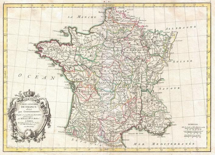
| Keywords: 1771 Bonne Map of France - Geographicus - FranceGov-bonne-1771.jpg A beautiful example of Rigobert Bonne's decorative map of France Covers the entirety of France from Spain to Germany and from the British Channel to the Mediterranean Divided into provinces with color coding according to region Offers excellent detail throughout showing mountains rivers forests national boundaries regional boundaries forts and cities A large decorative title cartouche appears in the lower left quadrant Drawn by Rigobert Bonne in 1771 for issue as plate no 4 in Jean Lattre's 1776 edition of the Atlas Moderne 1771 dated Size in 16 5 12 object history credit line accession number FranceGov-bonne-1771 Lattre Jean <i>Atlas Moderne ou Collection de Cartes sur Toutes les Parties du Globe Terrestre</i> c 1775 Geographicus-source PD-old-100 Old maps of the history of France 1771 maps Maps in French | ||||