MAKE A MEME
View Large Image
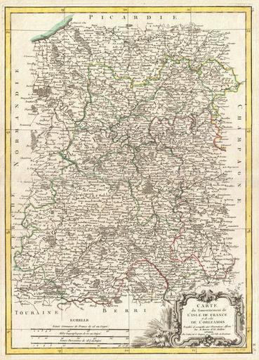
| View Original: | 1771_Bonne_Map_of_Isle_de_France_(vicinity_of_Paris),_France_-_Geographicus_-_IlldeFrance-bonne-1771.jpg (2525x3500) | |||
| Download: | Original | Medium | Small | Thumb |
| Courtesy of: | commons.wikimedia.org | More Like This | ||
| Keywords: 1771 Bonne Map of Isle de France (vicinity of Paris), France - Geographicus - IlldeFrance-bonne-1771.jpg A beautiful example of Rigobert Bonne's decorative map of the French regions of Isle de France and Orleans Covers the region in full from Picardie to Berriand from Normandy to Champagne This region centered around Paris is France's most populous province A large decorative title cartouche appears in the lower right quadrant Drawn by R Bonne in 1771 for issue as plate no F 5 in Jean Lattre's 1776 issue of the Atlas Moderne 1771 dated Size in 12 16 5 object history credit line accession number IlldeFrance-bonne-1771 Lattre Jean <i>Atlas Moderne ou Collection de Cartes sur Toutes les Parties du Globe Terrestre</i> c 1775 Geographicus-source PD-old-100 Maps by Rigobert Bonne Old maps of Île-de-France 1771 maps | ||||
,_France_-_Geographicus_-_IlldeFrance-bonne-1771.jpg)