MAKE A MEME
View Large Image
| View Original: | 1771_Bonne_Map_of_Normandy,_France_-_Geographicus_-_Normandie-bonne-1771.jpg (3500x2533) | |||
| Download: | Original | Medium | Small | Thumb |
| Courtesy of: | commons.wikimedia.org | More Like This | ||
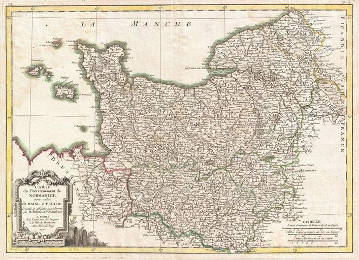
| Keywords: 1771 Bonne Map of Normandy, France - Geographicus - Normandie-bonne-1771.jpg A beautiful example of Rigobert Bonne's 1771 decorative map of Normandy France Covers from Bretagne eastward as far as Picardie Includes the Channel Islands of Guernsey and Jersey A decorative title cartouche appears in the lower left quadrant Drawn R Bonne c 1771 for issue as plate no 4 in Jean Lattre's 1776 issue of the Atlas Moderne 1771 dated Size in 16 5 12 object history credit line accession number Normandie-bonne-1771 Lattre Jean <i>Atlas Moderne ou Collection de Cartes sur Toutes les Parties du Globe Terrestre</i> c 1775 Geographicus-source PD-old-100 Old maps of Normandy 1771 maps Images from Geographicus Maps in French Maine province Perche | ||||