MAKE A MEME
View Large Image
| View Original: | 1775_Esnauts_and_Rapilly_Case_or_Pocket_Map_of_Paris,_France_and_environs_-_Geographicus_-_Paris-rapilly-1775.jpg (5000x3375) | |||
| Download: | Original | Medium | Small | Thumb |
| Courtesy of: | commons.wikimedia.org | More Like This | ||
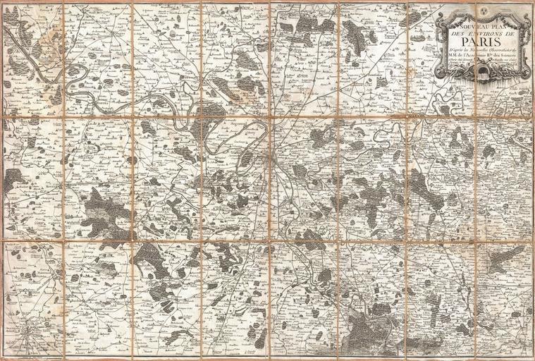
| Keywords: 1775 Esnauts and Rapilly Case or Pocket Map of Paris, France and environs - Geographicus - Paris-rapilly-1775.jpg A stunning 1775 pocket map of the environs of Paris France by the firm of Esnauts Rapilly Covers the greater Paris area from Chartres in the southwest to La Ferte in the northeast and from Vernon in the northwest to Bray in the southeast Offers incredible detail throughout naming numerous estates palaces forests churches monasteries fortifications and other geographical features A large baroque title cartouche appears in the upper right quadrant displaying garlands and a fountain We believe this to be the first edition of this highly uncommon map 1775 dated Size in 31 75 21 5 object history credit line accession number Paris-rapilly-1775 Geographicus-source PD-Art-100 Maps of Paris in the 18th century 1775 maps Maps in French Paris in the 1770s 18th-century maps of Paris | ||||