MAKE A MEME
View Large Image
| View Original: | 1799_Clement_Cruttwell_Map_of_England_-_Geographicus_-_England-cruttwell-1799.jpg (3019x3500) | |||
| Download: | Original | Medium | Small | Thumb |
| Courtesy of: | commons.wikimedia.org | More Like This | ||
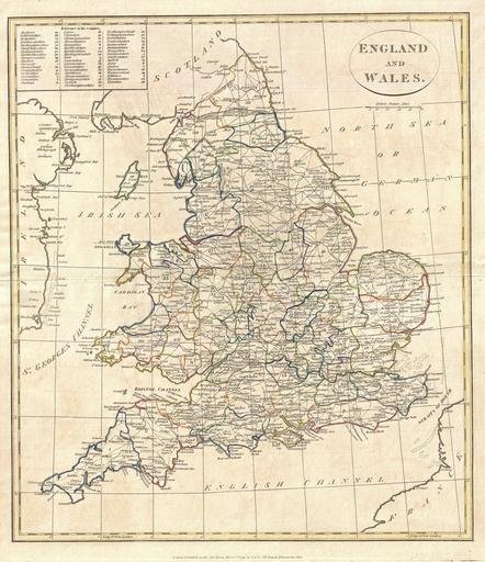
| Keywords: 1799 Clement Cruttwell Map of England - Geographicus - England-cruttwell-1799.jpg A fine 1799 map of England and Wales by the English map publisher Clement Cruttwell A highly detailed map of the cartographer ™s home country this map includes all the counties shires as they appeared at the end of the 18th century along with a reference chart in the upper-left quadrant Cruttwell also labels major roadways all major cities and ports as well as a few shoals and other submarine dangers Mountains and other topographical features shown by profile Outline color and fine copper plate engraving in the minimalist English style prevalent in the late 18th and early 19th centuries Drawn by G G and J Robinson of Paternoster Row London for Clement Cruttwell's 1799 Atlas to Cruttwell's Gazetteer 1799 dated Size in 14 16 object history credit line accession number England-cruttwell-1799 Cruttwell C <i>Atlas to Cruttwell's Gazetteer</i> 1799 Geographicus-source PD-Art-100 Maps by Clement Cruttwell Old maps of Great Britain 1799 maps | ||||