MAKE A MEME
View Large Image

| View Original: | 1815_Thomson_Map_of_China_and_Formosa_(Taiwan)_-_Geographicus_-_China-t-15.jpg (3000x3394) | |||
| Download: | Original | Medium | Small | Thumb |
| Courtesy of: | commons.wikimedia.org | More Like This | ||
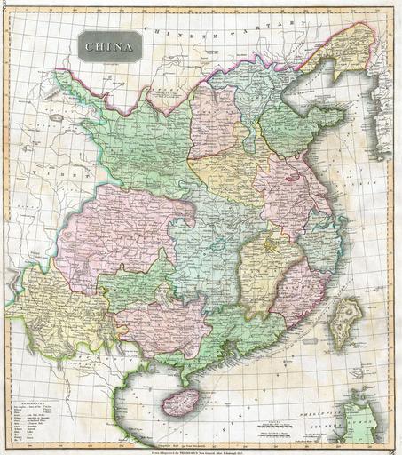
| Keywords: 1815 Thomson Map of China and Formosa (Taiwan) - Geographicus - China-t-15.jpg This fascinating hand colored 1814 map by Edinburgh cartographer John Thomson depicts China Shows the Great Wall of China as the northern boundary Extends as far west as the Tibetan plateau and as far south as the old Vietnamese/Chinese Kingdom of Tonkin or Tungouin as labeled Includes important early shipping routes from India to Beijing and curious notes about the nomadic people to the north of China the Ortoos and the Eluts of Koko Nor 1815 Size in 23 21 object history credit line accession number China-t-15 Geographicus-source PD-old-100 19th-century maps of China Maps of the history of Vietnam Old maps of Taiwan Maps by John Thomson 1815 maps | ||||