MAKE A MEME
View Large Image

| View Original: | –ö–∞—Ä—Ç–∞_–í–∏—Ç–µ–±—Å–∫–æ–π_–ì—É–±–µ—Ä–Ω–∏–∏_(1820).jpg (4794x4706) | |||
| Download: | Original | Medium | Small | Thumb |
| Courtesy of: | commons.wikimedia.org | More Like This | ||
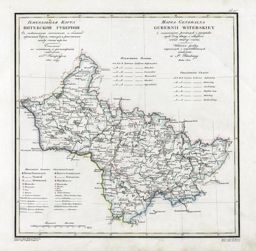
| Keywords: –ö–∞—Ä—Ç–∞ –í–∏—Ç–µ–±—Å–∫–æ–π –ì—É–±–µ—Ä–Ω–∏–∏ (1820).jpg –ö–∞— —Ç–∞ –í—ñ—Ü–µ–±—Å–∫–∞–π –≥—É–±–µ— –Ω—ñ –∑ –∞—Ç–ª–∞—Å—É 1821 –≥ Vitebsk Governorate map from geographic atlas of the Russian Empire 1821 –ö–∞— —Ç–∞ –í–∏—Ç–µ–±—Å–∫–æ–π –≥—É–±–µ— –Ω–∏–∏ –∏–∑ –∞—Ç–ª–∞—Å–∞ 1821 –≥ Geographic atlas of the Russian Empire is located in governorates in Russian and French 1821 <br> ru wikipedia <br/> original text 1 –ê—Ç–ª–∞—Å –Ý–æ—Å—Å–∏–π—Å–∫–æ–π –∏–º–ø–µ— –∏–∏ 1820 –ü—è–¥—ã—à–µ–≤ PD-old-100 original upload log page ru wikipedia D0 9A D0 B0 D1 80 D1 82 D0 B0_ D0 92 D0 B8 D1 82 D0 B5 D0 B1 D1 81 D0 BA D0 BE D0 B9_ D0 93 D1 83 D0 B1 D0 B5 D1 80 D0 BD D0 B8 D0 B8 jpg 2008-06-28 06 16 AGOT 4794√ó4706√ó 6762553 bytes <nowiki> –û–ø–∏—Å–∞–Ω–∏–µ –ö–∞— —Ç–∞ –í–∏—Ç–µ–±—Å–∫–æ–π –ì—É–±–µ— –Ω–∏–∏ –ê–≤—Ç–æ— –ü—è–¥—ã—à–µ–≤ –í— –µ–º—è —Å–æ–∑–¥–∞–Ω–∏—è 1821 –ò—Å—Ç–æ—á–Ω–∏–∫ –ê—Ç–ª–∞—Å –Ý–æ—Å—Å–∏–π—Å–∫–æ–π –∏–º–ø–µ— –∏–∏ </nowiki> Geographic Atlas of the Russian Empire Kingdom of Poland and Grand Duchy of Finland 1820-1827 Maps of Vitebsk Governorate Maps of the history of Pskov Oblast Maps of the history of Smolensk Oblast 1820 maps of Russia | ||||