MAKE A MEME
View Large Image
| View Original: | 1827_Finley_Map_of_Holland_or_the_Netherlands_-_Geographicus_-_Holland-finley-1827.jpg (3000x2383) | |||
| Download: | Original | Medium | Small | Thumb |
| Courtesy of: | commons.wikimedia.org | More Like This | ||
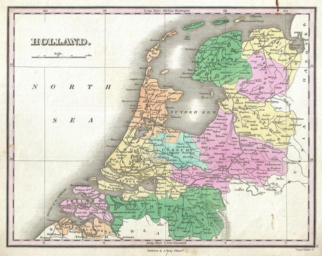
| Keywords: 1827 Finley Map of Holland or the Netherlands - Geographicus - Holland-finley-1827.jpg A beautiful example of Finley's important 1827 map of Holland or the Netherlands Covers the region Friesland south to Dutch Flanders and Brabant Identifies numerous cities river systems swamps and canals Title and scale in upper left quadrant Engraved by Young and Delleker for the 1827 edition of Anthony Finley's General Atlas 1827 undated Size in 11 5 9 object history credit line accession number Holland-finley-1827 Finley Anthony <i>A New General Altas Comprising a Complete Set of Maps representing the Grand Divisions of the Globe Together with the several Empires Kingdoms and States in the World; Compiled from the Best Authorities and corrected by the Most Recent Discoveries</i> Philadelphia 1827 Geographicus-source PD-old-100 Anthony Finley Maps by Anthony Finley 1827 maps Old maps of the Netherlands | ||||