MAKE A MEME
View Large Image
| View Original: | 1838_Bradford_Map_of_Virginia_-_Geographicus_-_Virginia-bradford-1838.jpg (3500x2712) | |||
| Download: | Original | Medium | Small | Thumb |
| Courtesy of: | commons.wikimedia.org | More Like This | ||
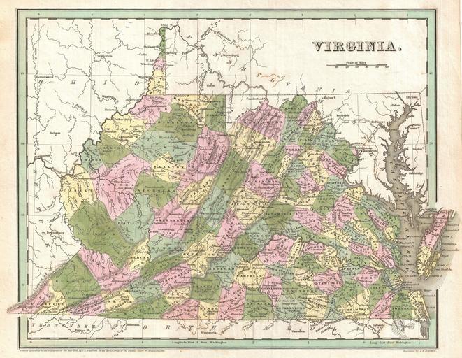
| Keywords: 1838 Bradford Map of Virginia - Geographicus - Virginia-bradford-1838.jpg A fine example of T G Bradford's c 1838 map of Virginia This map covers all of what is today Virginia and West Virginia as well as the entire Chesapeake Bay and adjacent parts of Ohio Pennsylvania North Carolina and Maryland Cartographically sophisticated Bradford's map incorporates political and topographical data naming cities towns rail lines mountains swamps and rivers Color coding at the county Level Though dated 1838 this map is most likely from the 1841 edition of Bradford's Atlas Exhibits fine coloration as well as G W Boynton's fine and elegant engraving 1838 dated Size in 15 11 5 object history credit line accession number Virginia-bradford-1838 Bradford T <i>A General Atlas Of The World With A Separate Map Of Each Of The United States Of America </i> 1841 Geographicus-source PD-art Old maps of Virginia 1838 maps Maps by Thomas Gamaliel Bradford | ||||