MAKE A MEME
View Large Image
| View Original: | 1841_Perthes_Map_of_Ireland_-_Geographicus_-_Ireland-perthes-1841.jpg (4000x3258) | |||
| Download: | Original | Medium | Small | Thumb |
| Courtesy of: | commons.wikimedia.org | More Like This | ||
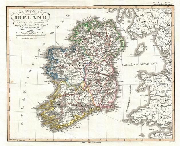
| Keywords: 1841 Perthes Map of Ireland - Geographicus - Ireland-perthes-1841.jpg This is a fine early example of Justus Perthes ™ Map of Ireland Shows the island divided into four districts Ulster Connaught Leister and Munster Shows roads railroads local political divisions and some of the surrounding waters and territories in England and Scotland Drawn by F von Stulpnagel and engraved by C Metzeroth for inclusion as plate no 15 in the 1841 issue of Stieler ™s Hand-Atlas 1841 dated Size in 14 5 11 5 object history credit line accession number Ireland-perthes-1841 Perthes J <i>Stieler's Hand-Atlas</i> 1841 Geographicus-source PD-old-100 Old maps of Ireland 1841 maps Friedrich von StĂĽlpnagel cartographer | ||||