MAKE A MEME
View Large Image
| View Original: | 1849_Land_Survey_Map_of_Michigan_Upper_Peninsula_-_Geographicus_-_Michigan-ls-1850.jpg (3000x1810) | |||
| Download: | Original | Medium | Small | Thumb |
| Courtesy of: | commons.wikimedia.org | More Like This | ||
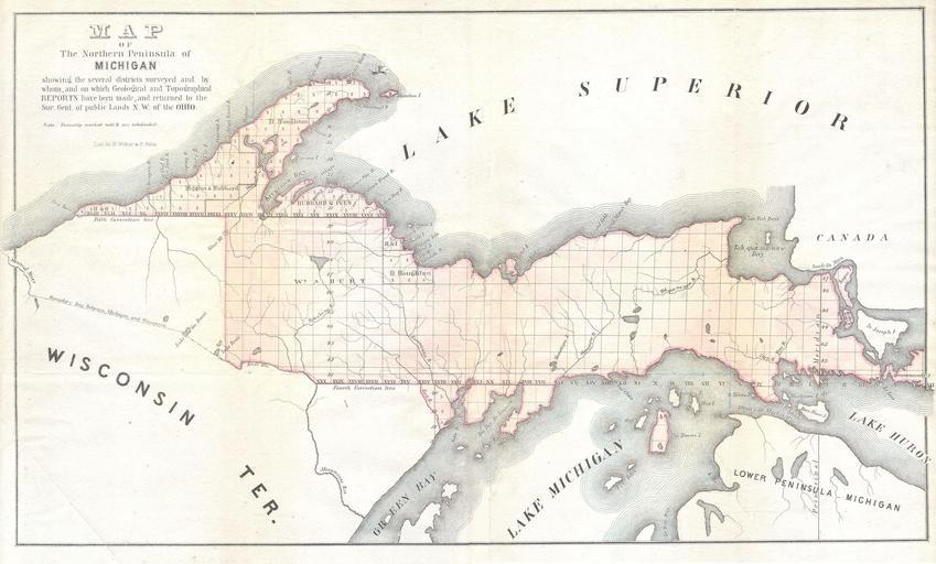
| Keywords: 1849 Land Survey Map of Michigan Upper Peninsula - Geographicus - Michigan-ls-1850.jpg This is in unusual General Land Survey map of the Northern Peninsula of Michigan Offers considerable decorative and topographic detail for a GLS map Small steam ship depicted of Manitou Island By Weber and Balto 1849 Size in 17 10 object history credit line accession number Michigan-ls-1850 Geographicus-source PD-art Old maps of Michigan 1849 maps United States Land Survey maps Upper Peninsula | ||||