MAKE A MEME
View Large Image
| View Original: | 1850_Cowperthwait_Map_of_Illinois_-_Geographicus_-_IL-m-50.jpg (3296x4000) | |||
| Download: | Original | Medium | Small | Thumb |
| Courtesy of: | commons.wikimedia.org | More Like This | ||
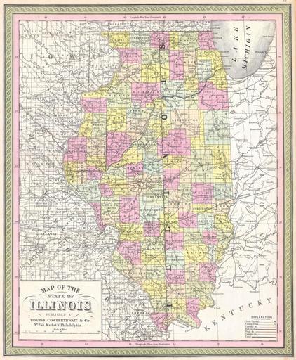
| Keywords: 1850 Cowperthwait Map of Illinois - Geographicus - IL-m-50.jpg This is beautiful hand colored map is a lithographic engraving of the state of Illinois dating to 1850 Map divides the state into counties with notations on both political and geographical features Produced by the legendary American map publisher S A Mitchell Sr out of his 253 Market Street office in Philadelphia PA 1850 Size in 14 11 object history credit line accession number IL-m-50 Geographicus-source PD-old-100 Maps by Samuel Augustus Mitchell Old maps of Illinois 1850 maps | ||||