MAKE A MEME
View Large Image
| View Original: | 1851 Map of Georgetown, crop from 1851 Map of the City.jpg (2964x2944) | |||
| Download: | Original | Medium | Small | Thumb |
| Courtesy of: | commons.wikimedia.org | More Like This | ||
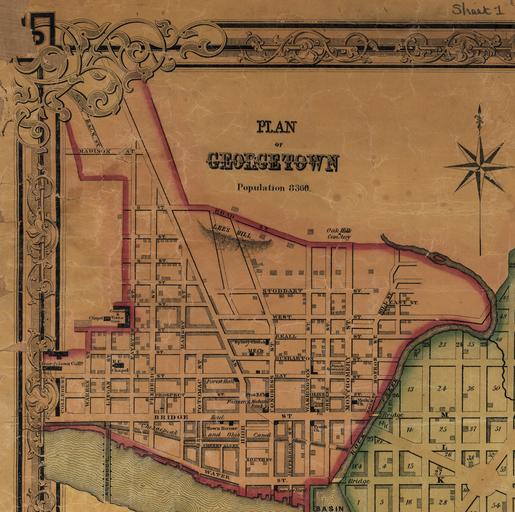
| Keywords: 1851 Map of Georgetown, crop from 1851 Map of the City.jpg The map of Georgetown then a separate city It shows block numbers wards built-up areas and major buildings Produced by Lloyd Van Derveer publisher Camden New Jersey 1851 hand-colored paper Library of Congress Geography and Map Division Washington D C 20540-4650 USA dcu Library of Congress Call number G3850 1851 K4 credit line Keily James and Lloyd Van Derveer Map of the city of Washington D C established as the permanent seat of the government of the U S of Am Camden N J Lloyd Van Derveer 1851 Map Retrieved from the Library of Congress Accessed April 15 2016 LOC-map g3850 ct000745 With Photoshop converted JPEG2000 to jpg then cropped henrytow PD-old-100-1923 Old maps of Washington D C 1851 1851 maps Maps in English Washington D C in the 1850s Georgetown _Washington _D C | ||||