MAKE A MEME
View Large Image
| View Original: | 1852_Andrews_Railroad_Map_of_the_United_States_-_Geographicus_-_UnitedStates-andrews-1852.jpg (5852x5482) | |||
| Download: | Original | Medium | Small | Thumb |
| Courtesy of: | commons.wikimedia.org | More Like This | ||
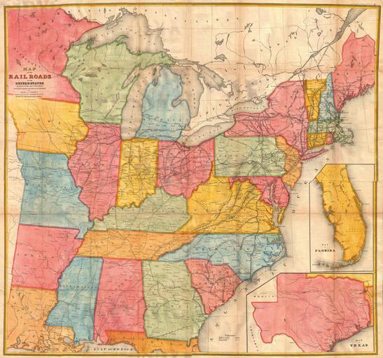
| Keywords: 1852 Andrews Railroad Map of the United States - Geographicus - UnitedStates-andrews-1852.jpg A rare and attractive wall sized railroad map of the United States issued in 1852 for Israel de Wolf Andrew ™s report for the Treasury Department Depicts from the Great Lakes south to the Gulf of Mexico and from the states of Iowa Missouri Arkansas and Louisiana eastward to the Atlantic Inset maps focus on Florida and Texas Offers superb detail of the American railway network both extant and proposed at a critical juncture in U S history Essentially an updated version of McLellen ™s map of 1850 Drawn and engraved under the direction of the editor of the American Railroad Journal 1852 undated Size in 42 39 object history credit line accession number UnitedStates-andrews-1852 <i>Communication from the Secretary of the Treasury transmitting in compliance with a resolution of the Senate of March 8 1851 the Report of Israel D Andrews consul of the United States for Canada and New Brunswick on the Trade and Commerce of the British North American Colonies and upon the Trade of the Great Lakes and Rivers; also notices of the internal imporvements in each state of the Gulf of Mexico and the Straits of Florida and a Paper on the Cotton Crop of the United States </i> 1852 editon Geographicus-source PD-art Old railroad maps of the United States 1852 maps Maps in English | ||||