MAKE A MEME
View Large Image
| View Original: | 1852_Bellin_Map_of_Sumatra,_Malaca,_and_Singapore_-_Geographicus_-_Sumatra-bellin-1750.jpg (3000x2566) | |||
| Download: | Original | Medium | Small | Thumb |
| Courtesy of: | commons.wikimedia.org | More Like This | ||
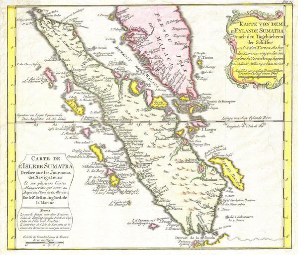
| Keywords: 1852 Bellin Map of Sumatra, Malaca, and Singapore - Geographicus - Sumatra-bellin-1750.jpg This is a beautiful map of the island of Sumatra and the southern tip of the Malaysian Peninsula was produced by the French Cartographer Jacques-Nicolas Bellin in 1852 Depicts the entirety of Sumatra as well as much of modern day Malaysia Includes the Straights of Singapore Sincapour Two decorative title cartouches decorate the map one in French and one in German This the German edition of is excpetionally rare 1852 Size in 11 5 10 object history credit line accession number Sumatra-bellin-1750 Geographicus-source PD-old-100 Old maps of Sumatra 1852 maps Maps in French Maps in German Maps by Jacques-Nicolas Bellin | ||||