MAKE A MEME
View Large Image
| View Original: | 1853_U.S.C.S._Map_of_Shoalwater_Bay,_Washington_-_Geographicus_-_ShoalwaterBay-uscs-1853.jpg (4000x3333) | |||
| Download: | Original | Medium | Small | Thumb |
| Courtesy of: | commons.wikimedia.org | More Like This | ||
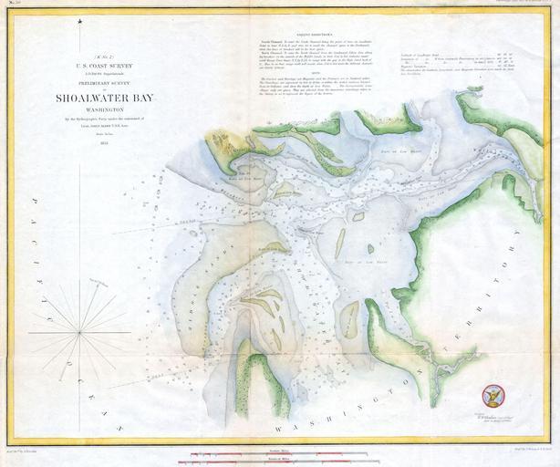
| Keywords: 1853 U.S.C.S. Map of Shoalwater Bay, Washington - Geographicus - ShoalwaterBay-uscs-1853.jpg A rare hand colored 1853 costal chart of Shoalwater Bay Washington Includes impressive detail regarding oyster beds banks sand bars and depth soundings Hydrography by James Alden Published under the supervision of A D Bache for the 1853 Report of the Superintendant of the U S Coast Survey 1853 Size in 18 5 14 object history credit line accession number ShoalwaterBay-uscs-1853 Geographicus-source PD-art United States Coast Survey maps 1853 maps Old maps of Washington state Willapa Bay | ||||