MAKE A MEME
View Large Image
| View Original: | 1855_Colton_Map_of_London,_England_-_Geographicus_-_London-cbl-1855.jpg (4000x3281) | |||
| Download: | Original | Medium | Small | Thumb |
| Courtesy of: | commons.wikimedia.org | More Like This | ||
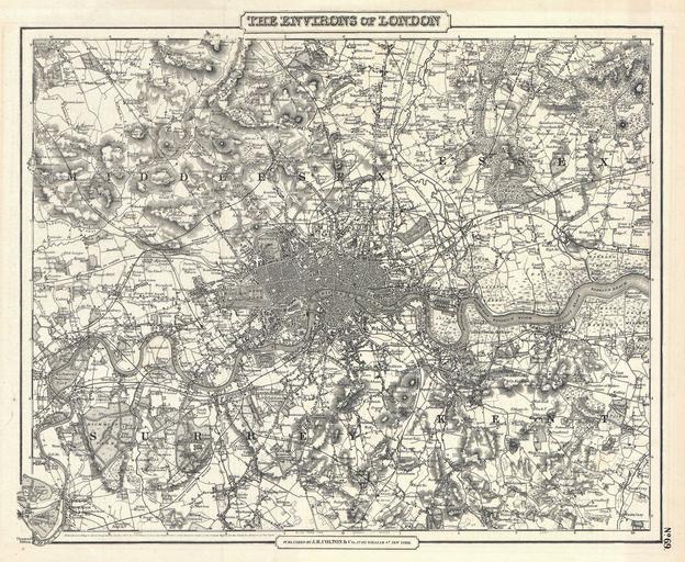
| Keywords: 1855 Colton Map of London, England - Geographicus - London-cbl-1855.jpg An excellent example of Colton ™s c 1855 map of London and environs Includes parts of Surrey Kent Middlesex and Essex Extends north to Southgate east to Chadwell Heath south to Kingston Mitcham and Bromley and west to Harrow and Isleworth - on a scale of 5/8 of an inch to the mile The whole is beautifully detailed to the level of individual buildings trees canals and roads Includes topographical details as well as farms parks riverways and swamps This is most likely the one of the first maps of London to appear in an American atlas Copyrighted 1855 but most likely this was published for a post 1857 issued of Colton ™s Atlas Map no 69 in the single volume the c 1857 edition of Colton's Atlas of The World Published from Colton ™s 172 William Str Office in New York 1855 dated Size in 15 12 5 object history credit line accession number London-cbl-1855 <i>Colton's Atlas Of The World Illustrating Physical And Political Geography By George W Colton </i> 1857 or later edition Geographicus-source PD-old-100 Maps by Joseph Hutchins Colton Old maps of London 1855 maps | ||||