MAKE A MEME
View Large Image
| View Original: | 1864_Johnson's_Map_of_Maryland_and_Delaware_-_Geographicus_-_DEMD-j-64.jpg (2500x2001) | |||
| Download: | Original | Medium | Small | Thumb |
| Courtesy of: | commons.wikimedia.org | More Like This | ||
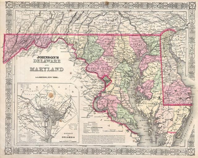
| Keywords: 1864 Johnson's Map of Maryland and Delaware - Geographicus - DEMD-j-64.jpg This is a magnificent 1864 hand colored map of the states of Maryland and Delaware by the important American map Publisher A J Johnson Depicts the two states in considerable detail Includes a large inset map of the District of Columbia or Washington D C Made during the Civil war this map includes a paragraph notation on the surveying of the boundary between Pennsylvania Delaware and Maryland commonly called the Mason Dixon Line This line marked the geographical division between the Northern from the Southern states at the outset of the Civil War 1864 Size in 16 5 13 object history credit line accession number DEMD-j-64 Geographicus-source PD-old-100 Maps by Alvin Jewett Johnson 1864 maps Old maps of Delaware Old maps of Washington D C Old maps of Maryland Mason-Dixon Line | ||||