MAKE A MEME
View Large Image

| View Original: | 1864_Mitchell_Map_of_Colorado,_Kansas_^_Nebraska_-_Geographicus_-_COKANE-mitchell-1864.jpg (4000x3292) | |||
| Download: | Original | Medium | Small | Thumb |
| Courtesy of: | commons.wikimedia.org | More Like This | ||
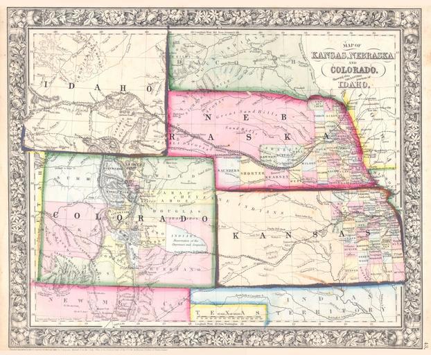
| Keywords: 1864 Mitchell Map of Colorado, Kansas ^ Nebraska - Geographicus - COKANE-mitchell-1864.jpg A beautiful example of S A Mitchell Jr ôs 1864 map of Kansas Nebraska Colorado and Idaho Wyoming has yet to appear Counties cover only the eastern portions of Nebraska and the eastern third of Kansas Shows various proposed railroads geographic features American Indian tribes and gold deposits as well as providing details on towns counties and other political data Following the gold rush settlers teamed into the region seeking a new life and new opportunities in the American wild west Identifies both the Santa Fe Trail and the Pony Express Route One of the most interesting and ephemeral maps of this transitional region to appear in the mid 19th century Prepared by W H Gamble for inclusion as plate 43 in the 1864 issue of Mitchell ôs New General Atlas Dated and copyrighted Entered according to Act of Congress in the Year 1861 by S Augustus Mitchell Jr in the Clerk ôs Office of the District Court of the U S for the Eastern District of Pennsylvania 1861 dated Size in 14 11 5 object history credit line accession number COKANE-mitchell-1864 <i>Mitchell's New General Atlas containing Maps of the Various Countries of the World Plans of Cities Etc Embraced in Fifty-three Quarto Maps forming a series of Eighty-Four Map and Plans together with Valuable Statistical Tables </i> 1864 Edition Geographicus-source PD-old-100 Maps by Samuel Augustus Mitchell Old maps of Colorado Old maps of Kansas Old maps of Nebraska 1864 maps | ||||