MAKE A MEME
View Large Image

| View Original: | 1865_Spruner_Map_of_Italy_under_Augustus_Caesar_-_Geographicus_-_Italia-spruner-1865.jpg (3500x2766) | |||
| Download: | Original | Medium | Small | Thumb |
| Courtesy of: | commons.wikimedia.org | More Like This | ||
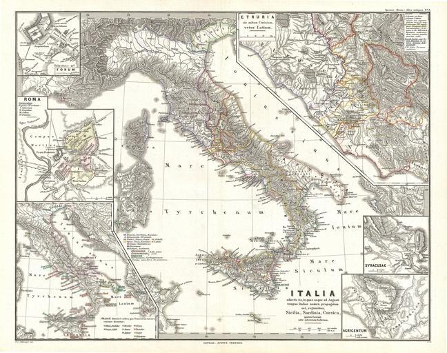
| Keywords: 1865 Spruner Map of Italy under Augustus Caesar - Geographicus - Italia-spruner-1865.jpg This is Karl von Spruner ôs 1865 map of Italy Sicilia Sardinia and Corsica under Augustus Caesar at the start of the Roman Empire Spruner depicts the entire country of Italy as a whole with a detailed inset of Etruia a region of central Italy This area makes up what today are the regions of Tuscany Latium Emilia-Romagna and Umbria Spruner also includes 5 smaller insets showing counterclockwise the Forum Rome the voyages of various Heroes Agrigentum and Syracusae Each inset includes its own legend or scale Map shows important cities rivers mountain ranges and other minor topographical detail Countries and territories are designated with colored The whole is rendered in finely engraved detail exhibiting throughout the fine craftsmanship of the Perthes firm 1865 undated Size in 16 13 object history credit line accession number Italia-spruner-1865 Spruner Karl von <i>Spruner-Menke Atlas Antiquus </i> Gotha Justus Perthes 1865 Geographicus-source PD-old-100 Karl Spruner von Merz Old maps of Italy Maps of ancient Italy | ||||