MAKE A MEME
View Large Image
| View Original: | 1870_Hachette_Pocket_Map_of_Paris,_France_-_Geographicus_-_NouveauParis-hachette-1870.jpg (7000x5910) | |||
| Download: | Original | Medium | Small | Thumb |
| Courtesy of: | commons.wikimedia.org | More Like This | ||
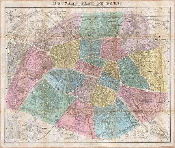
| Keywords: 1870 Hachette Pocket Map of Paris, France - Geographicus - NouveauParis-hachette-1870.jpg A spectacular large format linen backed folding map of Paris France Published by the Hachette firm in 1870 Depicts the city in extraordinary hand colored detail with all train lines streets and major buildings depicted Comes with booklet containing a useful street index Published from Hachette Company ™s 79 Boulevard Saint Germain office in Paris France 1870 Size in 29 5 24 object history credit line accession number NouveauParis-hachette-1870 Geographicus-source derivative works 1870 Hachette Pocket Map of Paris France - Geographicus - NouveauParis-hachette-1870 cropped jpg PD-Art-100 Maps published by Hachette Maps of Paris in the 19th century 19th-century maps of Paris Old locator maps of arrondissements of Paris 1870 maps 1870 in Paris | ||||