MAKE A MEME
View Large Image

| View Original: | 1870_Johnson_Climate_Map_of_the_World_w-_Physical_Map,_Tidal_Map,_Races_and_Declination_-_Geographicus_-_PhysicalMap-johnson-1870.jpg (3438x5000) | |||
| Download: | Original | Medium | Small | Thumb |
| Courtesy of: | commons.wikimedia.org | More Like This | ||
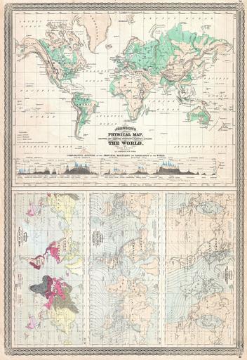
| Keywords: 1870 Johnson Climate Map of the World w- Physical Map, Tidal Map, Races and Declination - Geographicus - PhysicalMap-johnson-1870.jpg This is one of the thematic world maps from the rare 1870 edition of A J Johnson ôs Atlas of the World Features four maps drawn c 1858 by Professor A Guyot The largest depicts the physical word and attempts to show elevation The three smaller charts depict from top to bottom the world with lines of equal magnetic declination the world ôs tides and volcanoes and the races of man The whole is surrounded by the rare decorative border that appears only in the 1870 edition of Johnson ôs Atlas All maps are dated and copyrighted Entered according to Act of Congress in the Year 1870 by A J Johnson in the Clerk ôs Office of the District Court of the United States for the Southern District of New York 1870 dated Size in 17 5 25 object history credit line accession number PhysicalMap-johnson-1870 <i>Johnson's New Illustrated Family Atlas</i> 1870 edition Geographicus-source PD-old-100 Maps by Alvin Jewett Johnson 1870 maps 1870s maps of the world | ||||