MAKE A MEME
View Large Image

| View Original: | 1881_Thomas_Sedgwick_Steele_Map_of_Maine_-_Geographicus_-_Maine-steele-1881.jpg (3498x5000) | |||
| Download: | Original | Medium | Small | Thumb |
| Courtesy of: | commons.wikimedia.org | More Like This | ||
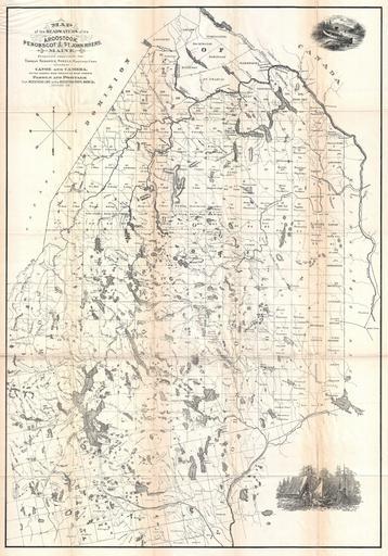
| Keywords: 1881 Thomas Sedgwick Steele Map of Maine - Geographicus - Maine-steele-1881.jpg An attractive and important map of Maine published in 1881 for Thomas Sedgwick Steele ôs classic narrative of wilderness Canoe and Camera This is one of the first maps ever issued with the canoeist in mind Covers Maine in full focusing on the various lake and rivers systems specifically the Aroostook Penobscot and St John running throughout the state Issued without color but features two attractive engravings one of Steele ôs canoe at the top right and another of his camp at the bottom right Both engravings are based on Steele ôs paintings 1881 dated Size in 20 28 5 object history credit line accession number Maine-steele-1881 Steele T S <i>Canoe Camera or Two Hundred Miles Through The Maine Forests Illustrated </i> Geographicus-source PD-art Old maps of Maine 1881 maps | ||||