MAKE A MEME
View Large Image
| View Original: | 1883_U.S.G.S._Map_of_the_Hawaiian_Islands_-_Geographicus_-_Hawaii2-USGS-1883.jpg (4000x2727) | |||
| Download: | Original | Medium | Small | Thumb |
| Courtesy of: | commons.wikimedia.org | More Like This | ||
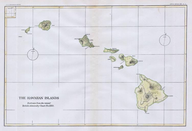
| Keywords: 1883 U.S.G.S. Map of the Hawaiian Islands - Geographicus - Hawaii2-USGS-1883.jpg This beautiful and fascinating map of the Hawaiian Islands Sandwich Island Group was published for the 1883 Annual Report of the U S Geological Survey Map offers topographical and nautical information This map was based upon original charts drawn by the British Admiralty Map is dated 1883 1883 dated Size in 13 5 9 object history credit line accession number Hawaii2-USGS-1883 <i>Annual report of the United States Geological Survey to the Secretary of the Interior </i> 1883 edition Geographicus-source PD-art Old maps of Hawaii 1883 maps | ||||