MAKE A MEME
View Large Image
| View Original: | 1888 Chicago map by Rand McNally.jpg (6839x8669) | |||
| Download: | Original | Medium | Small | Thumb |
| Courtesy of: | commons.wikimedia.org | More Like This | ||
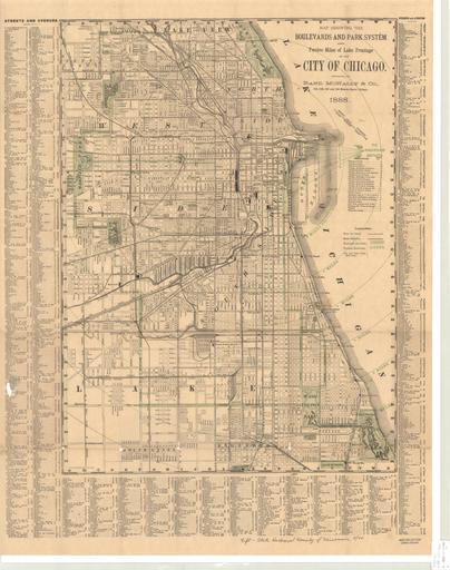
| Keywords: 1888 Chicago map by Rand McNally.jpg Map Map showing the boulevards and park system and twelve miles of lake frontage of the City of Chicago / engraved by Rand McNally Co Rand McNally and Company 1888 http //collections lib uwm edu/cdm/singleitem/collection/agdm/id/68/rec/17 PD-old map date 1888 Chicago 1 33 500 warp status Rand McNally Co Chicago print date accession number cm 58 43 other versions 1888 maps Old maps of Chicago Chicago in the 1880s | ||||