MAKE A MEME
View Large Image
| View Original: | 1899_Bacon_Pocket_Plan_or_Map_of_London_-_Geographicus_-_London-bacon-1899.jpg (6000x4012) | |||
| Download: | Original | Medium | Small | Thumb |
| Courtesy of: | commons.wikimedia.org | More Like This | ||
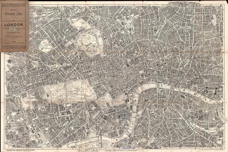
| Keywords: 1899 Bacon Pocket Plan or Map of London - Geographicus - London-bacon-1899.jpg Extremely attractive map of London England aroun the turn of the century Issued c 1899 by G W Bacon this map covers central London along the Thames River from Fulham Cemetary in the west to Southwark Park in the southeast Extends north as far as Canonbury and Kentish Town Includes Regents Park Kensington Garden Hyde Park St James Places the London Docks the Great North Railway Dept and London Fields among other destinations Labels all streets ferry routes bridges train routes parks and countless important buildings and civic constructions Folds into original wax paper binder circa 1899 undated Size in 29 5 19 5 object history credit line accession number London-bacon-1899 Geographicus-source PD-old-auto 1922 Old maps of London 1899 maps 1899 in London | ||||