MAKE A MEME
View Large Image
| View Original: | 1920_Bacon_Pocket_Map_of_London,_England_and_Environs_-_Geographicus_-_London-bacon-1920.jpg (5000x3651) | |||
| Download: | Original | Medium | Small | Thumb |
| Courtesy of: | commons.wikimedia.org | More Like This | ||
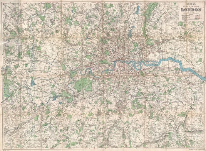
| Keywords: 1920 Bacon Pocket Map of London, England and Environs - Geographicus - London-bacon-1920.jpg An extremely attractive folding pocket map of London England and environs issued in 1920 by Bacon Co Covers the greater London area from Amersham in the northwest to Seven Oaks in the southeast and from Worplesdon in the southwest to Daguam Park in the northeast Shows the course of the Thames River streets train and tram routes bus lines parks roads and important building where notable Mounted on original linen 1920 dated Size in 39 29 object history credit line accession number London-bacon-1920 Geographicus-source PD-old-auto 1922 Old maps of London | ||||