MAKE A MEME
View Large Image

| View Original: | 1926_Canada-Alaska_1903_boundary-map.jpg (448x432) | |||
| Download: | Original | Medium | Small | Thumb |
| Courtesy of: | commons.wikimedia.org | More Like This | ||
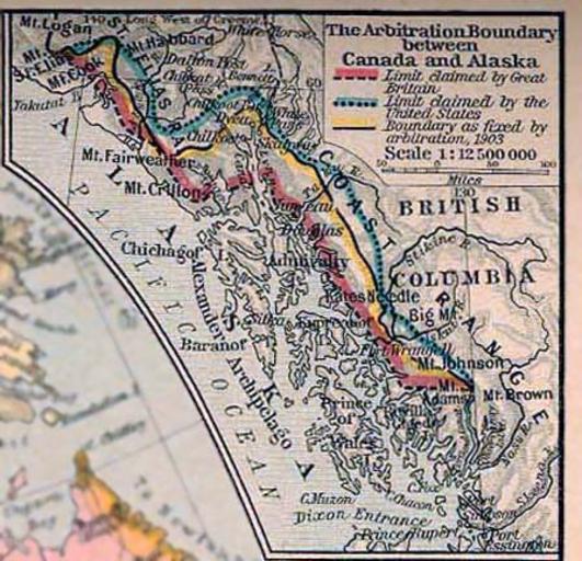
| Keywords: 1926 Canada-Alaska 1903 boundary-map.jpg Map of Alaska-Canada boundary arbitration 1903 <br>Cropped and enhanced version part of original image at the http //www lib utexas edu/maps/ Perry-Castañeda Library Map Collection at the en University of Texas at Austin website http //www lib utexas edu/maps/historical/shepherd/canada_newfoundland jpg This is a scan from Historical Atlas by William R Shepherd New York Henry Holt and Company 1926 ed From the FAQ http //www lib utexas edu/maps/faq html Most of the maps scanned by the University of Texas Libraries and served from this web site are in the public domain No permissions are needed to copy them You may download them and use them as you wish A few maps are copyrighted and are clearly marked as such Any that are copyrighted by The University of Texas are subject to our Materials Usage Guidelines This map is not so marked en wikipedia Transfer was stated to be made by User bagster 1926 Creator William R Shepherd PD-US PD-old-auto 1934 original upload log page en wikipedia 1926_Canada-Alaska_1903_boundary-map jpg 2006-12-18 23 27 AnonMoos 448×432×8 55842 bytes <nowiki>Cropped and enhanced version part of original image at the http //www lib utexas edu/maps/ Perry-Castañeda Library Map Collection at the University of Texas at Austin website http //www lib utexas edu/maps/historical/shepherd/canada_newfoundland j</nowiki> Old maps of British Columbia Old maps of Alaska 1903 in British Columbia 1926 maps of Canada Maps of borders of the United States Maps of borders of Canada Maps showing history by William R Shepherd Alexander Archipelago | ||||