MAKE A MEME
View Large Image
| View Original: | 20100916-1845UTC-GOES-East_visible.jpg (1120x480) | |||
| Download: | Original | Medium | Small | Thumb |
| Courtesy of: | commons.wikimedia.org | More Like This | ||
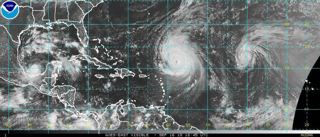
| Keywords: 20100916-1845UTC-GOES-East visible.jpg en The GOES-East satellite image shows from left to right Hurricane Karl in the Bay of Campeche Hurricane Igor north of the Lesser Antilles and Hurricane Julia northeast of the Capverdes on 16 September 2010 1845 UTC de Inseln ĂĽber dem Winde und Hurrikan Julia nordwestlich der Kapverden am 16 September 2010 um 18 45 Uhr UTC http //www ssd noaa gov/goes/east/tatl/vis-l jpg NOAA 2010-09-16 PD-USGov GOES pictures Hurricane Karl 2010 Hurricane Igor Hurricane Julia 2010 Satellite pictures of multiple tropical cyclones | ||||