MAKE A MEME
View Large Image
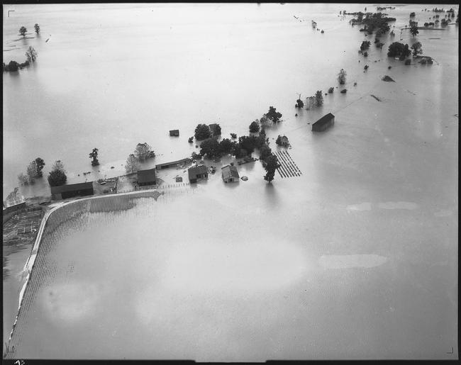
| View Original: | Aerial_photograph_of_flood,_unidentified_stretch_of_lower_Mississippi_River._-_NARA_-_285958.tif (3000x2377) | |||
| Download: | Original | Medium | Small | Thumb |
| Courtesy of: | commons.wikimedia.org | More Like This | ||
| Keywords: Aerial photograph of flood, unidentified stretch of lower Mississippi River. - NARA - 285958.tif Scope and content Inundated farm; only buildings and a few trees and small sections of fields are visible above the water General notes 285958 Local identifier Department of Defense Department of the Army Office of the Chief of Engineers St Louis District 09/18/1947 - 06/14/1979 NARA's Central Plains Region Kansas City NREA 400 West Pershing Road Kansas City MO 64108 1927 Record group Record Group 77 Records of the Office of the Chief of Engineers 1789 - 1999 Record group ARC 406 St Louis District Photographs compiled 1890 - 1970 Series ARC 285938 File unit File unit ARC Variant control numbers NAIL Control Number NRE-77-SLD PHO -93 yes Other versions <gallery> File Aerial_photograph_of_flood _unidentified_stretch_of_lower_Mississippi_River _-_NARA_-_285958 tif tif File Aerial_photograph_of_flood _unidentified_stretch_of_lower_Mississippi_River _-_NARA_-_285958 jpg jpg </gallery> NARA-cooperation PD-USGov Great Mississippi Flood of 1927 Aerial photographs of rivers of the United States NARA TIF images with categorized JPGs | ||||