MAKE A MEME
View Large Image
| View Original: | Aerial_view_of_Porirua_east_of_downtown.jpg (3611x4912) | |||
| Download: | Original | Medium | Small | Thumb |
| Courtesy of: | www.flickr.com | More Like This | ||
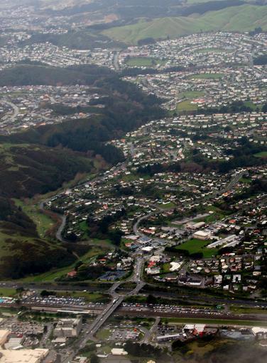
| Keywords: outdoor From west. Areas shown from bottom to top: Porirua downtown, State Highway 1 (SH 1N) and railway, Porirua East (left) and Ranui Heights (right), Jasmine Underhill Reserve (left), Cannon's Creek (right), and Waitangirua at top in distance. From west. Areas shown from bottom to top: Porirua downtown, State Highway 1 (SH 1N) and railway, Porirua East (left) and Ranui Heights (right), Jasmine Underhill Reserve (left), Cannon's Creek (right), and Waitangirua at top in distance. | ||||