MAKE A MEME
View Large Image

| View Original: | Albany-Schenectady-Amsterdam CSA.svg (6599x5029) | |||
| Download: | Original | Medium | Small | Thumb |
| Courtesy of: | commons.wikimedia.org | More Like This | ||
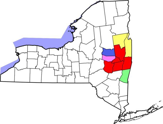
| Keywords: Albany-Schenectady-Amsterdam CSA.svg Locator map of the Capital District Albany-Schenectady-Amsterdam Combined Statistical Area in the eastern part of the U S state of New York The five components of the CSA are colored separately red w Capital District Albany-Schenectady-Troy Metropolitan Statistical Area ffff71 w Glens Falls metropolitan area Glens Falls Metropolitan Statistical Area 80ff87 w Columbia County New York Hudson Micropolitan Statistical Area 4d5de8 w Fulton County New York Gloversville Micropolitan Statistical Area ff80ff w Montgomery County New York Amsterdam Micropolitan Statistical Area Raster work modified from http //www2 census gov/geo/maps/general_ref/cousub_outline/cen2k_pgsz/ny_cosub pdf this United States Census Bureau file based on the following Census definitions lists http //www census gov/population/www/estimates/metro_general/2006/List4 txt Metropolitan Statistical Areas http //www census gov/population/www/estimates/metro_general/2006/List5 txt Micropolitan Statistical Areas http //www census gov/population/www/estimates/metro_general/2006/List6 txt Combined Statistical Areas SVG Vectorized from File Albany-Schenectady-Amsterdam CSA png 2009-05-11 ZooFari See below Maps by User Nyttend Maps of census statistical areas in New York Maps of New York's Capital District | ||||