MAKE A MEME
View Large Image

| View Original: | Amérique_Septentrionale_(Robert_de_Vaugondy_1750).jpg (7027x5714) | |||
| Download: | Original | Medium | Small | Thumb |
| Courtesy of: | commons.wikimedia.org | More Like This | ||
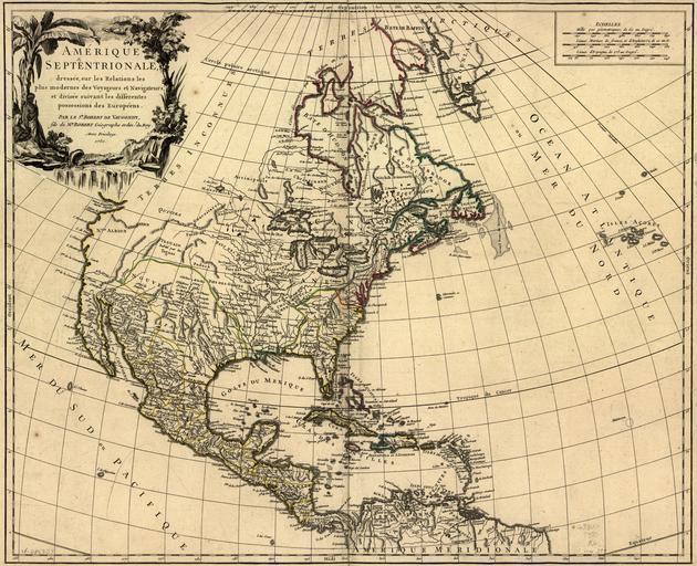
| Keywords: Amérique Septentrionale (Robert de Vaugondy 1750).jpg of the photograph quoted directly from the photograph's Flickr page <br/> Amérique Septentrionale Robert de Vaugondy 1750 <br>Another important source of cartographic supposition concerning the northwest of the continent were the sketches and maps of the De l u2019Isle family Robert De Vaugondy almost directly copied his detail fro this region from this source Although most of Manitoba is included in the area labeled u201CTerres Inconnues u201D there are other features associated with this Province shown on the map The most important is the simplified R Bourbon Nelson and Lac des Assinipoils Lake Winnipeg R St Therese Hayes and R de Munck Churchill are here also and all stem directly from the De l u2019Isle versions of earlier map-makers Lac des Assinipouls is located too far to the southeast of its proper position and is unrelated to the Border Lakes network which stretches far to the west from Lake Superior These features are a grossly simplified version of La Verendrye information and the way in which all these details are inserted shows that De Vaugondy was more interested in filling space than correlating the geographic data even then available to a u201CGeographe ordin u2019 du Roy u201D <br> Warkentin and Ruggles Historical Atlas of Manitoba map 44 p 114 <br>-------------------<br>Amérique septentrionale dressée sur les relations les plus modernes des voyageurs et navigateurs et divisée suivant les differentes possessions des européens Par le Sr Robert de Vaugondy 1750 Drawn by Robert de Vaugondy Printed in black ink with coloured portions In Robert de Vaugondy Atlas Universel Paris 1757 Map No 97 <br><br>Image Source Library of Congress American Memory Project originally posted to Flickr as http //www flickr com/photos/11496488 N07/2179435712/ Amérique Septentrionale Robert de Vaugondy 1750 Uploaded using F2ComButton 1750 http //www flickr com/people/11496488 N07 PD-old-100 Manitoba Historical Maps http //flickr com/photos/11496488 N07/2179435712 06 19 30 December 2009 UTC cc-by-2 0 Old maps of North America 1750 in Canada United States in the 1750s | ||||