MAKE A MEME
View Large Image

| View Original: | AMH-5089-NA_Map_of_Saldanha_Bay.jpg (2400x1824) | |||
| Download: | Original | Medium | Small | Thumb |
| Courtesy of: | commons.wikimedia.org | More Like This | ||
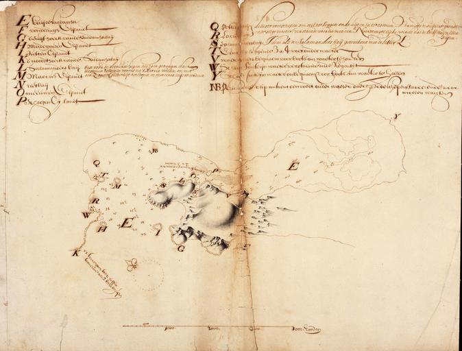
| Keywords: AMH-5089-NA Map of Saldanha Bay.jpg Artwork nl Kaart van de Saldanhabaai nl Titel in catalogus Leupe Nationaal Archief Kaart van de Saldanhabay met de daarin liggende Eilandjes enz Op linnen geplakt waarschijnlijk wegens de materiële staat met scheurtjes en gaten op de middenvouw Legenda E-Y Notities verso Uit Brieven en papieren van de Kaap 1660 overgek boek no 3 / Voor Amsterdam No 26 / Leupe 172 en Title in Leupe catalogue National Archives Kaart van de Saldanhabay met de daarin liggende Eilandjes enz Pasted on linen probably due to its physical condition with tears and holes in the centre fold Key E-Y Notes on reverse Uit Brieven en papieren van de Kaap 1660 overgek boek no 3 / Voor Amsterdam No 26 / Leupe 172 Atlas of Mutual Heritage na http //www atlasofmutualheritage nl/en/object/ id 5089 Source at the Atlas of Mutual Heritage - http //www gahetna nl/collectie/archief/inventaris/index/eadid/4 VEL/inventarisnr/172/level/file Source at the Nationaal Archief en Subjects key chart / map / plan nl Onderwerpen legenda plattegrond / kaart en Post this image is related to a VOC trading post called http //www atlasofmutualheritage nl/en/post/ id 429 Saldanha Inscription - nl circa 1660 nl Anoniem / Anonymous landmeter / kaartenmaker en Anoniem / Anonymous land surveyor / mapmaker Institution Nationaal Archief nl pen op papier / linnen en pen on paper / linen Size cm 40 52 accession number NL-HaNA_4 VEL_172 old number VEL0172 PD-Art-100 Maps of the Dutch East India Company - South Africa 1660 | ||||