MAKE A MEME
View Large Image

| View Original: | AMH-6716-KB_Chart_showing_the_Cape_of_St._Augustine.jpg (2400x1893) | |||
| Download: | Original | Medium | Small | Thumb |
| Courtesy of: | commons.wikimedia.org | More Like This | ||
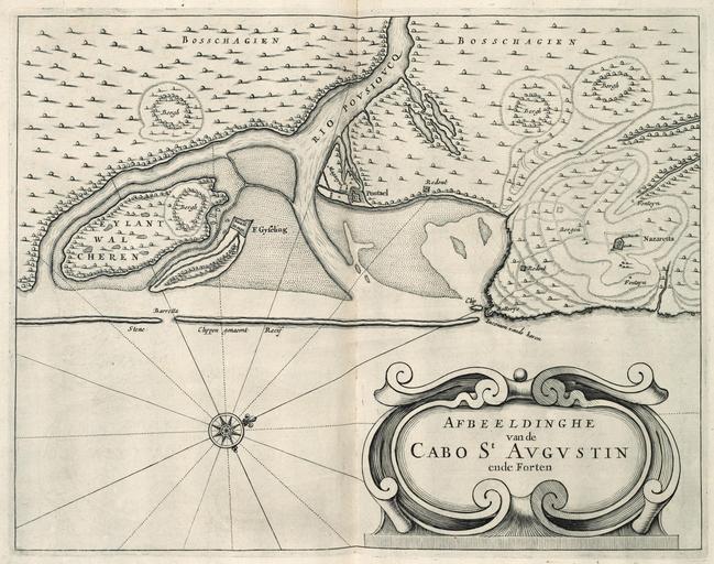
| Keywords: AMH-6716-KB Chart showing the Cape of St. Augustine.jpg Artwork nl Kaart van Kaap St Augustijn nl Kaart van Kaap St Augustijn Afbeeldinghe van de Cabo St Augustin ende Forten Het bruggenhoofd bij de toegang tot de haven inkomen van de haven wordt in maart 1634 door de West-Indische Compagnie veroverd op de Portugezen De omgeving blijft dan tot 1646 in Nederlandse handen Cf Nationaal Archief Den Haag inv nrs VEL0714 VEL0715 en VELH0619 92 en Chart of Cape St Augustine Afbeeldinghe van de Cabo St Augustin ende Forten The bridgehead at the entrance to the harbour inkomen van de haven was captured from the Portuguese by the Dutch West India Company in March 1634 The region remained in Dutch hands until 1646 Cf Nationaal Archief The Hague inv nrs VEL0714 VEL0715 and VELH0619 92 Atlas of Mutual Heritage kb http //www atlasofmutualheritage nl/en/object/ id 6716 Source at the Atlas of Mutual Heritage en Subjects fortification compass / dial chart / map / plan flora building banderole / cartouche / ornamentation nl Onderwerpen vesting kompas / windroos plattegrond / kaart flora gebouw banderol / cartouche / versiering Inscription Afbeeldinghe van de Cabo St Augustin ende Forten nl circa 1644 Creator B Elsevier Creator I Elsevier nl Anoniem / Anonymous landmeter / kaartenmaker B Elsevier uitgever I Elsevier uitgever en Anoniem / Anonymous land surveyor / mapmaker B Elsevier publisher I Elsevier publisher Institution Koninklijke Bibliotheek nl gravure op papier en engraving on paper Size cm 35 27 5 accession number 40 E 7 na p 382 PD-Art-100 Maps of the West-Indische Compagnie 1644 | ||||