MAKE A MEME
View Large Image
| View Original: | AMH-8168-KB_View_of_the_English_and_Dutch_forts_at_Kommendo,_a_plan_of_the_English_fort_and_a_map_of_the_mouth_of_the_Sherbro_River_with_an_inset_showing_a_view_o.jpg (2400x1626) | |||
| Download: | Original | Medium | Small | Thumb |
| Courtesy of: | commons.wikimedia.org | More Like This | ||
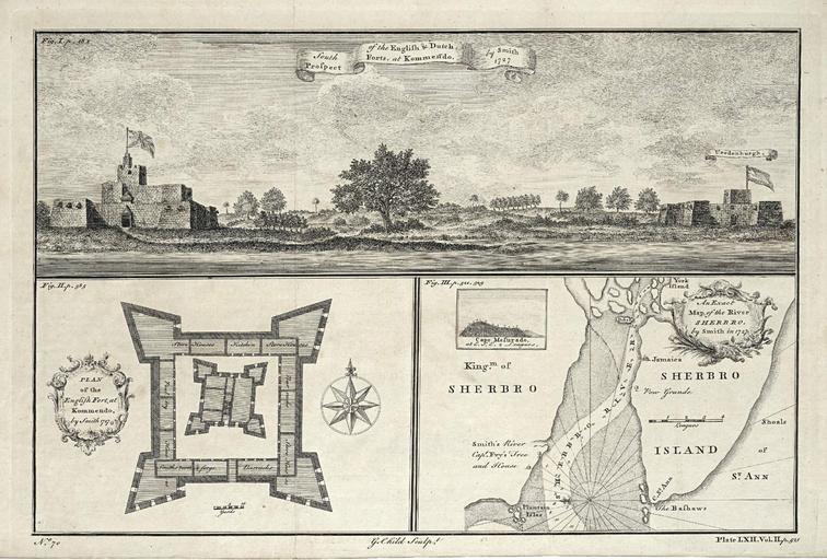
| Keywords: AMH-8168-KB View of the English and Dutch forts at Kommendo, a plan of the English fort and a map of the mouth of the Sherbro River with an inset showing a view o.jpg Artwork nl Gezicht op het Engelse en het Nederlandse fort te Kommendo een plattegrond van het Engelse fort en een kaart van de monding van de rivier Sherbro met inzet van een aanzicht van Kaap Mesurado nl Gezicht op het Engelse en het Nederlandse fort te Kommendo een plattegrond van het Engelse fort en een kaart van de monding van de rivier Sherbro met inzet van een aanzicht van Kaap Mesurado South Prospect of the English Dutch Forts at Kommendo Plan of the English Fort at Kommendo An Exact Map of the River Sherbro De kaarten en aanzichten zijn gebaseerd op vroeg-achttiende eeuwse uitgaven van de reizen van de Engelsman John Smith aan het eind van de zestiende eeuw en View of the English and Dutch forts at Kommendo a plan of the English fort and a map of the mouth of the Sherbro River with an inset showing a view of Cape Mesurado South Prospect of the English Dutch Forts at Kommendo Plan of the English Fort at Kommendo An Exact Map of the River Sherbro The maps and prospects are based on the early 18th century publications about the travels of the Englisman John Smith in the late 16th century Atlas of Mutual Heritage kb http //www atlasofmutualheritage nl/en/object/ id 8168 Source at the Atlas of Mutual Heritage en Subjects survey / view banderole / cartouche / ornamentation fortification building compass / dial nl Onderwerpen overzicht / aanzicht banderol / cartouche / versiering vesting gebouw kompas / windroos en Post this image is related to a WIC trading post called http //www atlasofmutualheritage nl/en/post/ id 691 Komenda Inscription South Prospect of the Englis Dutch Forts at Kommendo / Plan of the English Fort at Kommendo / An Exact Map of the River Sherbro author G Child Sculpt nl 1745 Creator G Child nl G Child graveur / etser Anoniem / Anonymous landmeter / kaartenmaker Anoniem / Anonymous uitgever en G Child engraver / etcher Anoniem / Anonymous land surveyor / mapmaker Anoniem / Anonymous publisher Institution Koninklijke Bibliotheek nl gravure op papier en engraving on paper Size cm 17 25 accession number 3032 B 10 to p 521 PD-Art-100 West-Indische Compagnie 1745 | ||||