MAKE A MEME
View Large Image
| View Original: | AMS_2016_Annual_Meeting.jpg (6000x4000) | |||
| Download: | Original | Medium | Small | Thumb |
| Courtesy of: | www.flickr.com | More Like This | ||
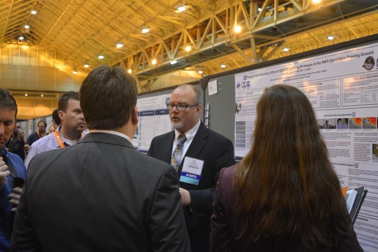
| Keywords: goes-r goesr user readiness userreadiness events conferences and events conferencesandevents conferences noaa satellites noaasatellites noaa satellite and information service noaasatelliteandinformationservice nesdis proving ground provingground Kim Runk and Chad Gravelle explain their poster "Results from Evaluating Different GOES-R Scanning Strategies at the NWS Operations Proving Ground." Between February and April of 2015, the National Weather Service (NWS) Operations Proving Ground (OPG) hosted and facilitated an evaluation of the usefulness of 1-minute satellite imagery for NWS operations in the GOES-R series era. The overarching goal of the evaluation was to provide quantitative and qualitative guidance to NWS management, including the regional NWS Scientific Services Division Chiefs, on how satellite imagery with a refresh rate of 1 minute impacts NWS forecaster decision making. In total, seventeen NWS forecasters completed eight simulations that were developed using imagery from the 2013 and 2014 GOES-14 Super Rapid Scan Operations for GOES-R. SRSOR imagery: cimss.ssec.wisc.edu/goes/srsor2015/GOES-14_SRSOR.html Original photo source: www.goes-r.gov/multimedia/events.html Kim Runk and Chad Gravelle explain their poster "Results from Evaluating Different GOES-R Scanning Strategies at the NWS Operations Proving Ground." Between February and April of 2015, the National Weather Service (NWS) Operations Proving Ground (OPG) hosted and facilitated an evaluation of the usefulness of 1-minute satellite imagery for NWS operations in the GOES-R series era. The overarching goal of the evaluation was to provide quantitative and qualitative guidance to NWS management, including the regional NWS Scientific Services Division Chiefs, on how satellite imagery with a refresh rate of 1 minute impacts NWS forecaster decision making. In total, seventeen NWS forecasters completed eight simulations that were developed using imagery from the 2013 and 2014 GOES-14 Super Rapid Scan Operations for GOES-R. SRSOR imagery: cimss.ssec.wisc.edu/goes/srsor2015/GOES-14_SRSOR.html Original photo source: www.goes-r.gov/multimedia/events.html | ||||