MAKE A MEME
View Large Image

| View Original: | Atlas_Van_der_Hagen-KW1049B12_034-DUCHE_de_BRETAIGNE.jpeg (5500x4208) | |||
| Download: | Original | Medium | Small | Thumb |
| Courtesy of: | commons.wikimedia.org | More Like This | ||
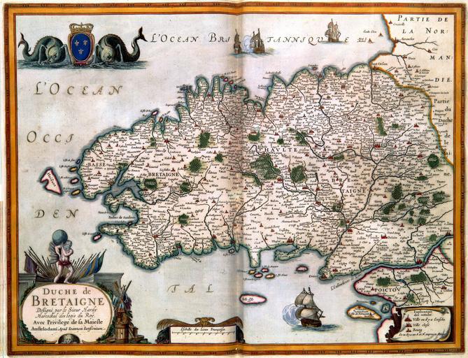
| Keywords: Atlas Van der Hagen-KW1049B12 034-DUCHE de BRETAIGNE.jpeg of the Atlas Van der Hagen in the catalogue of the KB http //opc4 kb nl/DB 1/TTL 1/LNG EN/PPN PPN 353012750 Designé par le Sieur Hardy Mareschal des logis du Roy Avec Privilege de sa Maieste Author Designé par le Sieur Hardy Mareschal des logis du Roy Avec Privilege de sa Maieste Publisher Creator Jan_Janssonius Author Designé par le Sieur Hardy Mareschal des logis du Roy Avec Privilege de sa Maieste Publisher Creator Jan_Janssonius credit line 1630 Deze kaart van Bretagne werd vervaardigd door de onbekende Franse kartograaf Le Sieur Claude Hardy die hofmaarschalk was van de Franse koning De kaart werd in 1630 gepubliceerd door Jan Janssonius 1588-1664 This map of Bretagne was created by a relatively unknown French cartographer Le Sieur Claude Hardy who was Head Marchall of the French King The map was published in 1630 by Jan Janssonius 1588-1664 37 x 50 cm exhibition history Institution Koninklijke Bibliotheek kopergravure Technique copper engraving KW1049B12_034 - Volume 1 Jan Janssonius Information field Depicted locations Bretagne - France object history object type Kaart Map PD-old-100 place of creation place of discovery Source page at the http //resolver kb nl/resolve urn urn gvn KONB01 272 Geheugen van Nederland / Memory of the Netherlands website Koninklijke Bibliotheek DUCHE de BRETAIGNE Uploaded with GWToolset Atlas Van der Hagen-KW1049B12_034-DUCHE de BRETAIGNE http //resolver kb nl/resolve urn urn gvn KONB01 1049B12_034 size large Atlas van der Hagen | ||||