MAKE A MEME
View Large Image
| View Original: | Battles of Charleroi and Mons map.png (983x741) | |||
| Download: | Original | Medium | Small | Thumb |
| Courtesy of: | commons.wikimedia.org | More Like This | ||
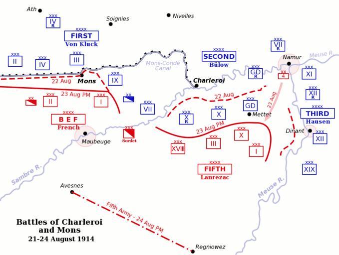
| Keywords: Battles of Charleroi and Mons map.png Map of the Battles of Charleroi and Mons southern Belgium during the Battle of the Frontiers 21-24 August 1914 French British and Belgian units are shown in red German units are shown in blue Fortress towns are marked with a shaded red circle originally uploaded by Gsl to English wikipedia 2005-03-30 Gsl Gsl en DEFAULTSORT Charleroi 1914 Battle of the Frontiers Battle of Mons Western Front maps of World War I Charleroi | ||||