MAKE A MEME
View Large Image
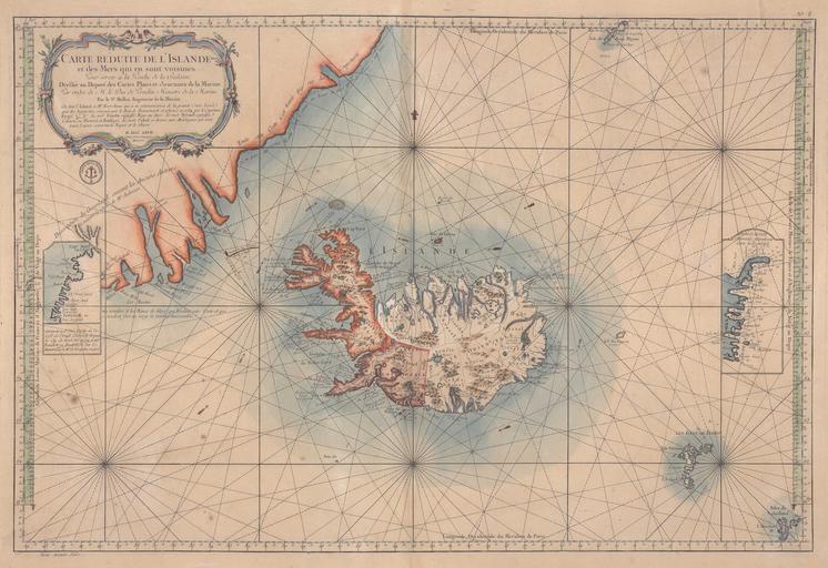
| View Original: | Bellin_map_1767_Carte_reduite_de_l_Islande_et_des_Mers_qui_en_sont_voisines.jpg (10107x6938) | |||
| Download: | Original | Medium | Small | Thumb |
| Courtesy of: | commons.wikimedia.org | More Like This | ||
| Keywords: Bellin map 1767 Carte reduite de l Islande et des Mers qui en sont voisines.jpg Carte réduite de l'Islande et des Mers qui en sont voisines de Karte von Island und den benachbarten Gewässern en Map of Iceland and adjacent oceans 1767 http //islandskort is/en/map/show/103 National and University Library of Iceland Creator Jacques-Nicolas Bellin PD-old-100 other versions Custom license marker 2015 09 19 Old maps of oceans Old maps of Greenland Old maps of Iceland Maps of Shetland Old maps of Faroe Islands Portolan charts made in the 18th century 1767 maps Maps by Jacques-Nicolas Bellin Uploaded with UploadWizard | ||||