MAKE A MEME
View Large Image

| View Original: | Benthorn_en_Hogeveen.png (1072x948) | |||
| Download: | Original | Medium | Small | Thumb |
| Courtesy of: | commons.wikimedia.org | More Like This | ||
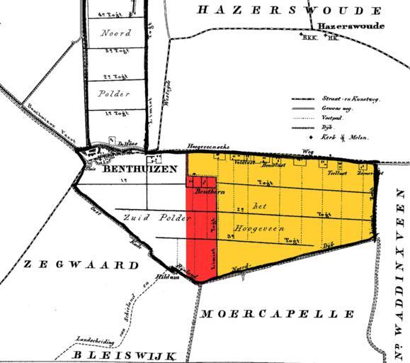
| Keywords: Benthorn en Hogeveen.png Former municipalities of Benthorn red and Hogeveen yellow in South Holland the Netherlands on a map of Benthuizen in 1868 Based on Kadaster maps at http //www watwaswaar nl Kuypers Gemeenteatlas van Nederland bewerkt door User Eugene van der Pijll 2010-05-06 modifications Kuyper PD-old File Benthuizen gif PD-old Benthuizen Gemeente Atlas van Nederland - South Holland Provinciale weg 209 Original upload log wikitable - - 2010-05-07 02 35 28 1072 × 948 71123 bytes Eugene van der Pijll <nowiki> Former municipalities of Benthorn red and Hogeveen yellow in South Holland the Netherlands on a map of Benthuizen in 1868 Kuypers Gemeenteatlas van Nederland bewerkt door User Eugene van der Pijll 2010-</nowiki> | ||||