MAKE A MEME
View Large Image

| View Original: | Birds_eye_view_of_the_town_of_Provincetown,_Barnstable_County,_Mass._(2673737871).jpg (2000x1014) | |||
| Download: | Original | Medium | Small | Thumb |
| Courtesy of: | commons.wikimedia.org | More Like This | ||
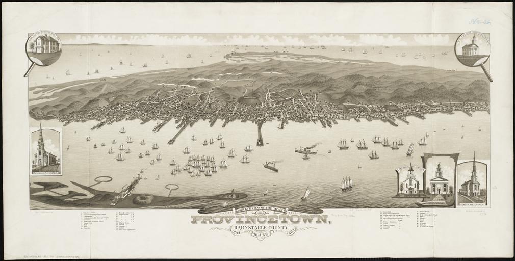
| Keywords: Birds eye view of the town of Provincetown, Barnstable County, Mass. (2673737871).jpg Bird's eye view of the town of Provincetown Barnstable County Mass <br />Size 16 7/8 x 38 1/4 in 42 9 x 97 3 cm <br />Scale Not drawn to scale <br />Call Number G3764 P78A3 1882 P6 <br /> Zoom into this map http //maps bpl org/id/10415 maps bpl org/id/10415 <br /><br />In the foreground is Long Point with its circular fishing weirs The circular earthen structure is the remains of an American Civil War battery The building and wharf on Long Point is the Cape Cod Oil Works which was built as the Army moved off of Long Point; the Army spent several years thereafter trying to remove this squatter from its land http //www flickr com/photos/normanbleventhalmapcenter/2673737871/ Norman B Leventhal Map Center at the Boston Public Library Uploaded by tm 1882 Artist Albert F Poole d 1934 Printer Beck and Pauli Lith Milwaukee Wis Publisher Joseph John Stoner Madison Wis 1934 File Upload Bot Magnus Manske 2013-08-21 Photos from Norman B Leventhal Map Center at the BPL's photostream 1882 maps Maps of Provincetown Massachusetts Old maps of Massachusetts Aerial views of Provincetown Massachusetts | ||||