MAKE A MEME
View Large Image

| View Original: | BirdsHeadPeninsula_Topo_nl.jpg (837x576) | |||
| Download: | Original | Medium | Small | Thumb |
| Courtesy of: | commons.wikimedia.org | More Like This | ||
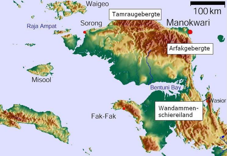
| Keywords: BirdsHeadPeninsula Topo nl.jpg en Vogelkop Peninsula West Papua Indonesia indicated in Dutch Arfak- and Tamraumountains nl Schiereiland Vogelkop met daarop aangegeven Wandammen Tamrau- en Arfakgebergte GMT GLOBE own work Stefan Faymer /Modified version HW de Nie January 2006/modified version April 18 2012 The map has been created with the Generic Mapping Tools http //gmt soest hawaii edu/ using one or more of these public domain datasets http //upload wikimedia org/wikipedia/commons/8/89/BirdsHeadPeninsula_Topo jpg The public domain datasets for the relief ETOPO2 topography/bathymetry http //www ngdc noaa gov/mgg/global/global html GLOBE topography http //www ngdc noaa gov/mgg/topo/gltiles html SRTM topography http //www2 jpl nasa gov/srtm/ Maps of Indonesia PD-USGov | ||||