MAKE A MEME
View Large Image
| View Original: | Britonia6hcentury.png (1670x2928) | |||
| Download: | Original | Medium | Small | Thumb |
| Courtesy of: | commons.wikimedia.org | More Like This | ||
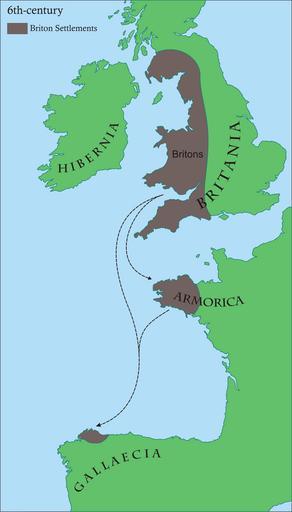
| Keywords: Britonia6hcentury.png Britonia6hcentury2 svg References Cite book Young Simon A D 500 A Journey through the Dark Isles of Britain and Ireland Weidenfeld Nicolson 2005 0297848054 - p 17 and map on p 15 en Map of areas in western Europe with Brythonic communities for the 6th century AD gl Mapa dos asentamentos britónicos no occidente europeo arredor do século VI da nosa era Os territorios aparecen en marrón mentres o verde indica a situación xeográfica Own Rubén Tarrío 2008-06-20 own work Maps of the history of England Maps of the history of France Maps of the history of Scotland Maps of the history of Spain Maps of the history of Wales Maps showing 6th-century history | ||||