MAKE A MEME
View Large Image
| View Original: | Caert_van't_Landt_van_d'Eendracht_(detail_showing_Land_of_the_Leeuwin).jpg (1051x588) | |||
| Download: | Original | Medium | Small | Thumb |
| Courtesy of: | commons.wikimedia.org | More Like This | ||
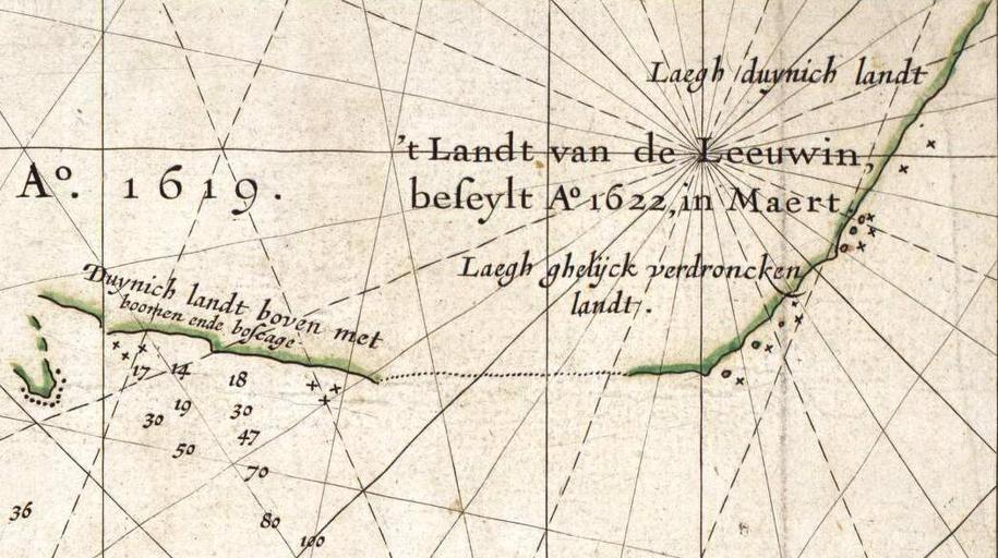
| Keywords: Caert van't Landt van d'Eendracht (detail showing Land of the Leeuwin).jpg This is an image showing detail of the National Library of Australia's copy of Hessel Gerritsz' 1627 map of the west coast of Australia entitled Caert van't Landt van d'Eendracht This detail shows a section of coastline discovered by the Leeuwin in 1622 and subsequently referred to by the Dutch as t Landt van de Leeuwin The Land of the Leeuwin Cropped from the full scan available at Image Caert van't Landt van d'Eendracht NLA jpg then colour balanced The original map was published in 1627 Hessel Gerritsz also written Hessel Gerritszoon PD-Art For other versions see Category Caert van't Landt van d'Eendracht Caert van't Landt van d'Eendracht | ||||
.jpg)