MAKE A MEME
View Large Image
| View Original: | California_US_Congressional_District_29_(since_2013).tif (2016x998) | |||
| Download: | Original | Medium | Small | Thumb |
| Courtesy of: | commons.wikimedia.org | More Like This | ||
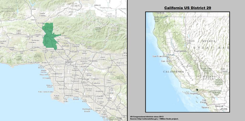
| Keywords: California US Congressional District 29 (since 2013).tif California's 29th congressional district in the U S House of Representatives Located in the north central San Fernando Valley Los Angeles County California 29 ô¤ distrito congresional de California norte-oeste del Valle de San Fernando Condado de Los ûngeles California 2014-03-21 21 19 36 GIS shapefile data created by the United States Department of the Interior as part of the 1 Million Scale geospatial data project Retrieved from http //nationalatlas gov/atlasftp-1m html openChapters chpbound 1 GIS congressional districts 2013 shapefile data was created by the United States Department of the Interior 2 Data was rendered using ArcGISôÛ software by Esri 3 File developed for use on Wikipedia and elsewhere by 7partparadigm PD-USGov DEFAULTSORT CA 29 Uploaded with UploadWizard Congressional district maps of California CA 29 Maps of the San Fernando Valley Maps of Los Angeles County California Maps of Los Angeles Arleta Los Angeles Lake View Terrace Los Angeles North Hills Los Angeles North Hollywood Los Angeles Panorama City Los Angeles San Fernando California Sylmar Los Angeles Van Nuys Los Angeles San Fernando Valley en California's 29th congressional district es 29 ô¤ distrito congresional de California | ||||